- About Us
- Schemes
- Culture Scheme Dashboard
- Scheme of Financial Assistance for Promotion of Art and Culture
- Financial Assistance to Cultural Organizations with National Presence
- Cultural Function and Production Grant(CFPG)
- Financial Assistance for Preservation and Development of Cultural Heriatge of the Himalayas
- Financial Assistance for Development of Buddhist/Tibetan Arts and Culture
- Financial Assistance for Cultural Activities in Performing Arts for Building Grants Including Studio Theatres
- Financial Assistance for Allied Cultural Activities
- Financial Assistance for Promotion of Guru-Shishya Parampara (Repertory grant)
- National Mission on Libraries
- Financial Assistance for Construction of Tagore Cultural Complexes(TCC)
- Scheme of Financial Assistance under Seva Bhoj Yojna
- Scheme of Scholarship and Fellowship for Promotion of Art and Culture
- Museum Grant Scheme
- Scheme for Financial Assistance for Veteran Artists
- Scheme for Promotion of Culture of Science (SPOCS)
- Scheme for Safeguarding the Intangible Cultural Heritage
- Global Engagement Scheme
- Indian Conservation Fellowship Program (ICFP)
- Centenary and Anniversary Celebrations Scheme
- Mission
- ICR
- Commemorations
- CSL
- G20 CWG
- Contact Us
Sundarbans National Park

Sundarbans National Park
West Bengal
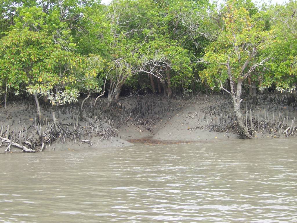
The site lies south-east of Calcutta in the District of West Bengal and forms part of the Gangetic Delta, which borders on the Bay of Bengal. The Sundarbans, covering some 10,000 km2 of mangrove forest and water, is part of the world's largest delta formed from sediments deposited by three great rivers, the Ganges, Brahmaputra and Meghna, which converge on the Bengal Basin.
The whole Sundarbans area is intersected by an intricate network of interconnecting waterways, of which the larger channels are often a kilometre or two in width and run in a north-south direction. These waterways now carry little freshwater as they are mostly cut off from the Ganges, the outflow of which has shifted from the Hooghly-Bhagirathi channels progressively eastwards since the 17th century. This is due to subsidence of the Bengal Basin and a gradual eastward tilting of the overlying crust. In the Indian Sundarbans, the western portion receives some freshwater through the Bhagirathi-Hooghly river system but that portion designated as the tiger reserve is essentially land-locked, its rivers having become almost completely cut off from the main freshwater sources over the last 600 years. Thus, waterways in the tiger reserve are maintained largely by the diurnal tidal flow, the average rise and fall being about 2.15 m on the coast and up to 5.68 m on Sagar Island.


